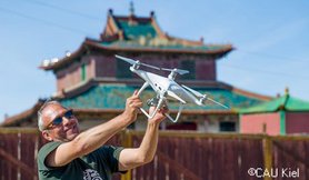
Prof. Dr. rer. nat. Martin Oczipka
Professorship of Remote Sensing
Functions
- Appointee of the faculty for foreign affairs and research
- Appointee of the faculty for the laboratory of photogrammetry and remote sensing
Research
Projects in progress:
- Abandoned cities in the steppe: Roles and perception of Early Modern religious and military centres in Nomadic Mongolia
- ÖkoNeu: Remote sensing monitoring of second order water bodies
Publications
Piezonka, H., Ahrens, B., Chuluun, S., Oczipka, M. (2020): Verlassene Städte der Steppe: Rollen und Wahrnehmung frühneuzeitlicher Siedlungszentren in der nomadischen Mongolei. In: Archäologische Nachrichten aus Schleswig-Holstein 2020, Hrsg. Archäologisches Landesamt Schleswig-Holstein, S.266ff.
Ressel, Ch., Ahrens, B., Čadrabaal, E., Čuluun, S., Ethier, J., Oczipka, M., Piezonka, H. (2020) : Auf den Spuren verlassener Städte: Urbane Strukturen aus der Zeit mandschurischer Herrschaft und deren Weiterwirken in der heutigen Mongolei. Ein Vorbericht. In: Mongolische Notizen, Nr. 27/2020, S.56 ff, ISSN 0937-8618.
Chuluun, S., Enkhtuul, Ch., Piezonka, H., Oczipka, M., Ethier, J. (2019): Archaeological excavation results of the year 2019 of the Mongolian-German cooperation project „Lost Cities in the Steppe“ [Тал нутгийн нүүдэлчдийн oрхигдсон хотууд” төслийн 2019 оны хээрийн судалгааны ажлын товч дүнгээс]. In: Mongolyn Arkheologi, S. 127-130.
- Krüger, T., Hecht, R., Herbrich, J., Behnisch, M., Oczipka, M. (2018): Investigating the suitability of Sentinel-2 data to derive the urban vegetation structure, In: SPIE Proceedings, Vol. 10793, Paper 10793-23.
- Wehmann, W., Oczipka, M., Knötzsch, P., Schramm, M. (2017): Vergleichende Untersuchungen zur Erfassung und 3D-Modellierung des Kreisels der Bobbahn Altenberg mit unterschiedlichen Aufnahmetechnologien. Hrsg. DVW Terrestrisches Laserscanning (TLS 2017), Schriftenreihe DVW Bd. 88,1. Aufl. Wißner-Verlag Augsburg, 2017, S 59 - 72. ISBN978-3-95786-145-0.
- Hofmann, J., Oczipka, M., Ruhtz, T., Dämpfling, H. (2016): How could unmanned aerial systems (UAS) be used for ecohydrological and ecosystem research? Experiences of first operations with UAS in river flood plains of Northern Mongolia, In: Erforschung biologischer Ressourcen der Mongolei, Halle/Saale, Band 13.4.
- Pöschke, F., Lewandowski, J., Engelhardt, C., Preuß, K., Oczipka, M., Ruhtz, T., Kirillin, G. (2015): Upwelling of deep water during thermal stratification onset - A major mechanism of vertical transport in small temperate lakes in spring? In: Water Resources Research 51(12).
- Bemmann, J., Lehndorff, E., Klinger, R., Linzen, S., Munkhbayar, L., Oczipka, M., Piezonka, H., Reichert, S. (2014): Biomarkers in archaeology – Land use around the Uyghur capital Karabalgasun, Orkhon Valley, Mongolia. In: Praehistorische Zeitschrift, de Gruyter; 2014; 89(2): S 337–370.
- Hofmann, J. & Oczipka, M. (2013): Monitoring from Air: First operation of Unmanned Aerial Systems (UAS) in Kharaa river basin. - Poster session during the IWRM MoMo Status Workshop: Implementing IWRM in the Kharaa Catchment▪ Ulaanbaatar, 16 to 18 April 2013.
- Grützner C.,Bemmann J.,Berking J.,Frechen M.,Klinger R.,Klitzsch N.,Linzen S.,Mackens S.,Oczipka M.,Piezonka H.,Reichert S.,Schneider M.,Schütt B.(2012): Improving archaeological site analysis: a rampart in the middle Orkhon Valley investigated with combined geoscience techniques. In: Journal of Geophysics and Engineering, Band 9, S.70-80.
- Oczipka, M., Bemman, J., Piezonka, H. Munkabayar, J., Ahrens, B.,Achtelik, M., Lehmann, F.(2009): Small drones for geo-archaeology in the steppes: locating and documenting the archaeological heritage of the Orkhon Valley in Mongolia. In: Michel, U. u. Civico, D.L. (Hg.) Proceedings of SPIE, Remote Sensing for Environmental Monitoring, GIS Applications, and Geology IX, Band 7478, Washington, S. 747806-1 - 747806-11.
- Taubenböck, H.,Goseberg, N., Setiadi, N., Lämmel, G., Moder, F. Oczipka, M., Klüpfel, H., Wahl, R., Schlurmann, T., Strunz, G., Birkmann, J., Nagel, K., Siegert, F., Lehmann, F., Dech , S., Gress, A., Klein , R. (2009): “Last-Mile” preparation for a potential disaster – Interdisciplinary approach towards tsunami early warning and an evacuation information system for the coastal city of Padang, Indonesia. In: Natural Hazards and Earth System Sciences (NHESS), Band 9, S. 1509-1528.
- Ahrens, B., Bemmann, J., Klinger, R., Lehmann, F., Oczipka, M., Piezonka, H., Munkhabayar, L. (2008): Geo-Archaeology in the steppe – A new multidisciplinary project investigating the interaction of man and environment in the Orkhon valley. In: Archeologijn Sudlal, Band 6, Ulan Bator, S. 311-327.
- Birkmann, J., Dech, S., Goseberg, N., Klüpfel, H., Lämmel, G., Moder, F., Nagel, K., Oczipka, M., Schlurmann, T., Setiadi, N., Siegert, F., Strunz, G., Taubenböck, H. (2008): Numerical LAST-MILE Tsunami Early Warning and Evacuation Information System (“LAST-MILE – Evacuation”). In: 1. International Conference on Tsnami Warning (ICTW), Bali, S. DMS-7.
- Moder, F., Oczipka, M., Siegert, F., Lehmann, F., Djajadihardaja, Y. S., Klein, R., Wahl, R. (2008): Last-Mile - Large-scale topographic mapping of densely populated coasts in support of risk assessment of tsunami hazards. In: 1. International Conference on Tsunami Warning, Bali, S. DMS-10.
- Oczipka, M., Bucher, T., Trosset, A. (2008): Mapping and updating maps in dense urban regions using high resolution digital airborne imagery, surface models and object-based classification. In: IAPRS Proceedings, XXXVII, Band 7, Beijing, S. 551-555.
Prof. Dr. rer. nat. Martin Oczipka
- Z 727
- +49 351 462 3155
Response times:
Thursday 11h15-13h and BBB
Please always make an appointment in advance by email.

Teaching
Summer semester 2024
- Compulsory module in the study programme G60 - Geomatics - Surveying/Cartography/Geoinformatics
in the 4. semester
- Compulsory module in the study programme G60 - Geomatics - Surveying/Cartography/Geoinformatics
in the 6. semester
- Compulsory module in the study programme G61 - Surveying
Unit "Fernerkundung (1)" in the 6. semester
Winter semester 2024/25
- Compulsory elective module in the study programme G66 - Geoinformatics/Management
in the 1. semester
- Compulsory module in the study programme G66 - Geoinformatics/Management
in the 3. semester - Compulsory module in the study programme G66 - Geoinformatics/Management
in the 2. semester
- Compulsory module in the study programme L37 - Environmental Monitoring
in the 3. semester
- Compulsory module in the study programme G60 - Geomatics - Surveying/Cartography/Geoinformatics
Unit "Digitale Bildverarbeitung" in the 3. semester
- Compulsory module in the study programme G61 - Surveying
Unit "Fernerkundung (2)" in the 7. semester
- Compulsory module in the study programme L37 - Environmental Monitoring
in the 7. semester
- Compulsory elective module in the study programme B14 - Environmental Engineering
in the 1. semester

